


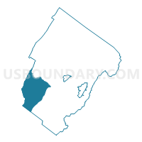
Effinger Voting District, Rockbridge County, Virginia
About
Outline

Summary
| Unique Area Identifier | 682453 |
| Name | Effinger Voting District |
| County | Rockbridge County |
| State | Virginia |
| Area (square miles) | 55.19 |
| Land Area (square miles) | 55.11 |
| Water Area (square miles) | 0.07 |
| % of Land Area | 99.87 |
| % of Water Area | 0.13 |
| Latitude of the Internal Point | 37.72444170 |
| Longtitude of the Internal Point | -79.61953660 |
Maps


Graphs
Select a template below for downloading or customizing gragh for Effinger Voting District, Rockbridge County, Virginia


Neighbors
Neighoring Voting District (by Name) Neighboring Voting District on the Map
- Airport Voting District, Rockbridge County, VA
- Buchanan Voting District, Botetourt County, VA
- Collierstown Voting District, Rockbridge County, VA
- Glen Wilton Voting District, Botetourt County, VA
- Peters Switch Voting District, Alleghany County, VA
- Plank Road Voting District, Rockbridge County, VA
- Roaring Run Voting District, Botetourt County, VA
Top 10 Neighboring County Subdivision (by Population) Neighboring County Subdivision on the Map
- Fincastle district, Botetourt County, VA (6,753)
- Buchanan district, Botetourt County, VA (6,306)
- Kerrs Creek district, Rockbridge County, VA (4,989)
- Buffalo district, Rockbridge County, VA (4,369)
- Sharon district, Alleghany County, VA (2,212)
Top 10 Neighboring Unified School District (by Population) Neighboring Unified School District on the Map
- Botetourt County Public Schools, VA (33,148)
- Rockbridge County Public Schools, VA (22,307)
- Alleghany County Public Schools, VA (16,250)
Top 10 Neighboring State Legislative District Lower Chamber (by Population) Neighboring State Legislative District Lower Chamber on the Map
- State House District 19, VA (78,345)
- State House District 12, VA (75,683)
- State House District 24, VA (72,372)
Top 10 Neighboring State Legislative District Upper Chamber (by Population) Neighboring State Legislative District Upper Chamber on the Map
Top 10 Neighboring 111th Congressional District (by Population) Neighboring 111th Congressional District on the Map
Top 10 Neighboring Census Tract (by Population) Neighboring Census Tract on the Map
- Census Tract 9303, Rockbridge County, VA (6,434)
- Census Tract 402, Botetourt County, VA (4,294)
- Census Tract 401, Botetourt County, VA (3,498)
- Census Tract 801, Alleghany County, VA (3,362)